New Weather Alert System Launched on Islamabad–Lahore Motorway (M2) – Complete Details 2025
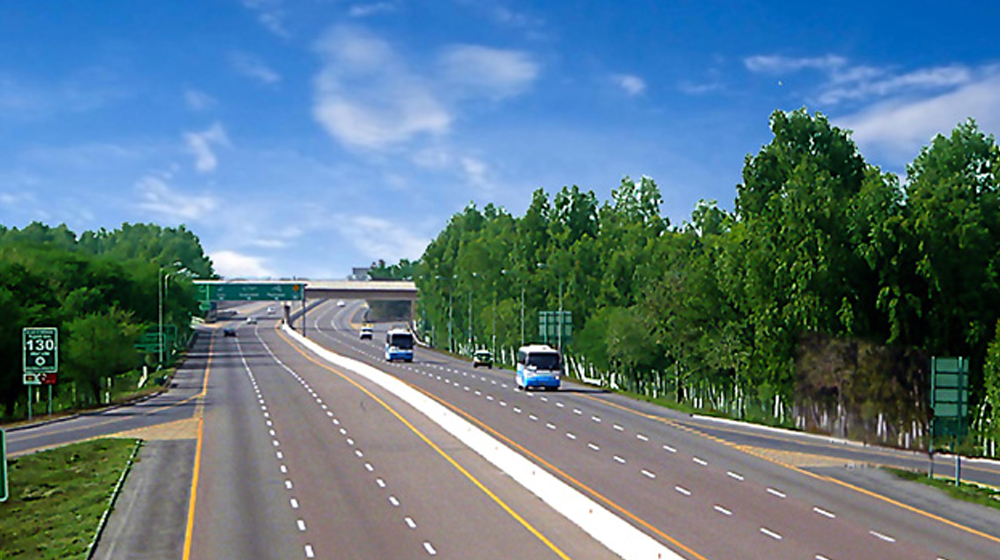
Pakistan has officially launched an advanced Road Weather Alert System on the Islamabad–Lahore Motorway (M2) under the innovative “Weather on the Way” program. This breakthrough initiative aims to improve highway safety, reduce accidents, and give travelers access to accurate real-time weather updates throughout their journey. With cutting-edge technology, dense sensor networks, and hyperlocal climate monitoring, the system marks a major milestone in Pakistan’s transport modernization efforts.
In this article, we explain the full details, features, benefits, technology, and impact of the new motorway weather alert system, along with SEO-friendly keywords people frequently search on Google.
What Is the ‘Weather on the Way’ Road Weather Alert System?
The Weather on the Way (WOW) initiative is an advanced digital weather-tracking system created for travelers on the Islamabad–Lahore Motorway M2. It is jointly developed by:
- WeatherWalay (Pakistan’s professional weather intelligence company)
- ONE Network (Motorway digital infrastructure provider)
This is the first system of its kind in Pakistan, designed to supply motorists with real-time, hyperlocal weather conditions along the entire M2 motorway, helping them plan safer and smarter road journeys.

Why M2 Motorway Needs a Real-Time Weather System
The Islamabad–Lahore Motorway passes through multiple microclimate zones, including:
- Salt Range Hills
- Forest regions
- Fog-prone plains of Punjab
- Rain-sensitive zones
- Wind corridors
Weather can change rapidly across different segments. A driver may leave Islamabad in clear skies but encounter dense fog near Kallar Kahar, heavy rain near Chakwal, or low visibility near Sheikhupura.
This sudden variation has historically caused:
- Major fog-related pileups
- Accidents due to sudden rainfall
- Slippery roads
- Visibility loss
- Delayed travel times
The new weather alert system is launched to solve exactly these problems.

Key Features of the New Road Weather Alert System
The motorway weather monitoring network includes:
1. 14 Automated Weather Stations (AWS)
Installed at strategic intervals, these stations measure:
- Temperature
- Humidity
- Rainfall
- Wind speed
- Wind direction
- Atmospheric pressure
2. 5 Air Quality Sensors
Provide live AQI information for:
- Pollution
- Smoke levels
- Hazardous particulates
Useful for people with health issues and for monitoring smog.
3. 4 Visibility Sensors
These sensors help detect:
- Fog density
- Mist
- Dust visibility
- Low-light visibility hazards
4. Satellite Data Integration
Combined with ground sensors for high accuracy, enabling early alerts for:
- Storms
- Cloud movements
- Rainfall systems
- Fog formation
5. Digital Screens at Toll Plazas
Major toll plazas on M2 now display:
- Fog alerts
- Rain updates
- Road closures
- Weather-based driving recommendations
6. Smartphone App & Web Platform Alerts
Drivers will receive live information through:
- WeatherWalay app
- ONE Network mobile app
- Motorway web portals
This ensures you get alerts before entering dangerous segments.
Read Also:Pakistan Gold Rate 26 November 2025 – Updated 24K Tola, Gram & Ounce Prices

How the System Helps Motorists on M2 Motorway
The primary purpose is to protect travelers by giving them immediate weather intelligence.
1. Real-Time Fog Alerts
Fog is the biggest challenge on M2, especially between:
- Kallar Kahar
- Pindi Bhattian
- Sheikhupura
- Kala Shah Kaku
The visibility sensors detect fog early and warn drivers instantly.
2. Rain & Thunderstorm Warnings
Before entering rainfall zones, drivers receive alerts so they can:
- Reduce speed
- Turn on headlights
- Drive with caution
3. Slippery Road & Wet Surface Alerts
Sensors identify:
- Wet roads
- Water accumulation
- Risky slopes
This is particularly important in the Salt Range.
4. Wind Speed & Crosswind Alerts
High-speed winds in certain areas can destabilize vehicles. Alerts help heavy vehicles, buses, and container carriers maintain safety.
5. Trip Planning Support
Travelers can plan:
- Best departure time
- Safer route choices
- Alternative rest stops

How the Weather Alert System Enhances Road Safety
Pakistan has faced several motorway accidents caused by:
- Sudden fog
- Rain-induced skidding
- Poor visibility
- Low-light hazards
This system aims to reduce such accidents significantly.
Safety Improvements Include:
- Early warning messages
- Traffic flow management
- Motorway police response
- Better emergency coordination
- Safer driving behaviour
For the first time, drivers, motorway operators, and emergency services will have the same shared weather data, improving communication and crisis response.
Technology Behind the System
The system combines local software and imported climate sensors to create a powerful weather intelligence network.
Technologies Used Include:
- Satellite feeds
- IoT-enabled sensors
- GIS mapping
- Automated Weather Stations
- Cloud-based data analytics
- Digital display boards
- Microclimate modelling tools
This allows predictions that are:
- Accurate
- Hyperlocal
- Instant
- Reliable
Pakistan’s terrain, especially the Salt Range’s unpredictable climate, requires precise localized systems—this network fills that gap.
Read Also:Gold Rates in Pakistan Today – 26 November 2025 (Per Tola & Per Gram Latest Update)
Key Benefits for Pakistan Beyond Road Travel
While designed for motorway users, the system will benefit multiple sectors:
1. Agriculture
Accurate predictions support:
- Crop planning
- Irrigation management
- Pest control timing
- Harvest scheduling
2. Tourism
Travelers will know:
- Fog-free hours
- Safe travel windows
- Weather risks in hilly areas
3. Energy Sector
Helps with planning:
- Power distribution
- Grid load management
- Renewable energy forecasting
4. Environmental Monitoring
Air quality sensors assist in:
- Smog monitoring
- Clean air initiatives
- Public health planning
5. Urban Planning
City planners can use microclimate data for:
- Drainage design
- Heat island mapping
- Weather resiliency projects
Why Dense Sensor Networks Matter in Cities Like Islamabad
Islamabad has very diverse microclimates across short distances. Rainfall in F-7 can be different from rain in Bani Gala, and temperatures can vary sharply between Margalla Hills and Rawalpindi plains.
Dense sensor networks give:
- Accurate rainfall maps
- Localized storm alerts
- Zone-based temperature updates
- Microclimate mapping for urban design
This improves forecasting and public safety at a city level.
Impact of ‘Weather on the Way’ on Pakistan’s Future
This initiative represents Pakistan’s shift toward:
- Smarter roads
- Digital mobility systems
- Advanced weather forecasting
- Climate resilience
It strengthens Pakistan’s readiness for:
- Fog season
- Monsoon rains
- Smog waves
- Sudden weather events
By integrating climate intelligence with transport operations, Pakistan is taking a significant step toward safer highways and smarter weather management.
Conclusion
The launch of the Weather on the Way system on the Islamabad–Lahore Motorway (M2) is a landmark development in Pakistan’s transport and climate monitoring future. With real-time alerts, accurate microclimate data, and a modern sensor network, the system will make travel safer, support national planning, and reduce weather-related hazards.
Travelers, farmers, policymakers, and public safety agencies will all benefit from this state-of-the-art weather intelligence platform—shaping a safer, smarter, and more resilient Pakistan.
M2 Weather Alert System 2025 – FAQs for Travelers
1. What is the new Weather Alert System on the Islamabad–Lahore Motorway?
It is a real-time weather monitoring system that provides live updates on fog, rain, wind, and visibility conditions along the M2 motorway.
2. How will drivers receive weather alerts on the motorway?
Alerts will come through smartphone apps, digital screens at toll plazas, and online platforms connected to WeatherWalay and ONE Network.
3. Which areas of the M2 are most affected by fog?
Fog mostly affects Kallar Kahar, Pindi Bhattian, Sheikhupura, and Kala Shah Kaku sections during winter.
4. What sensors are installed under the new system?
The system has 14 automated weather stations, 5 air quality sensors, 4 visibility sensors, and satellite-based climate monitoring tools.
5. How does this system improve road safety?
It warns drivers before entering dangerous weather zones, helping prevent accidents, improve visibility awareness, and support safe travel planning.